
Andover ZIP Code Coverage
Minnesota's official city-and-county listing identifies two ZIP codes for Andover in Anoka County: 55303 and 55304. The same state table also associates both labels with Anoka, which is the first sign that an Andover postal name cannot settle a municipal-boundary question. The Andover-area county ZIP map gives useful context, but it is postal geography rather than a legal city-limit layer. Use it to orient an Andover address, not to decide jurisdiction.
| ZIP code | Officially identified areas | Post office or station | Research note |
|---|---|---|---|
| 55304 | Andover; the state city-and-county table also lists Anoka | Andover Carrier Annex | Carrier and PO Box service. The exact boundary was not published in the located official source. |
| 55303 | Andover and Anoka in the official state table | Anoka Post Office | Retail, carrier, PO Box, and self-service functions; the exact Andover subset was not published. |
Neither Andover row means a ZIP belongs exclusively to one city. The complete Andover city-name coverage found in the official table is limited to those two labels, and no official Andover ZIP-level population or voter-registration figures were located.
Note: Treat 55303 and 55304 as postal search starting points, then confirm the parcel's mapped jurisdiction before relying on a city name.
Andover ZIP Code Postal Stops
The 55304 facility is the Andover Carrier Annex at 15219 Bluebird St NW, Andover, MN 55304-9998. The documented services are carrier services and PO Box Online, not retail, passport, financial, or mailing retail service. Postal history adds one useful distinction: a 2008 Postal Bulletin changed its classification from branch to carrier annex. The facility helps explain the 55304 label, but it does not draw the city boundary.
The official reference image from the Minnesota city-and-county listing shows the state source used to verify Andover's two ZIP labels.
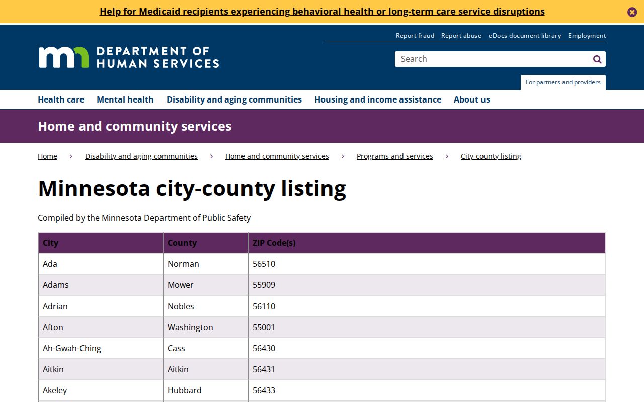
The listing is a useful first Andover check, while the county map and parcel record answer the separate question of where a particular Andover address sits.
For 55303, the documented retail facility is the Anoka Post Office at 2168 7th Ave, Anoka, MN 55303-1713. Its location in Anoka does not mean every address carrying that label is outside Andover. Postal facilities serve delivery networks, while municipal limits follow mapped jurisdiction.
Checking an Andover ZIP Code
Use the official USPS ZIP Code Lookup to normalize an Andover postal line before opening county records. USPS supports an address with city and state, a city-and-state search, and a cities-by-ZIP view. Its own warning is important: an Andover ZIP result does not confirm that a person or company is at the address. It only confirms postal addressing information.
- Enter the complete Andover address and city/state in the USPS tool to confirm the delivery line and ZIP+4 where available.
- Keep directional parts of the Andover street name and the street type in the search notes, because county GIS searches depend on a normalized street address.
- Open the Anoka County Property Search GIS Mapping Application with the Andover number and street name, omitting city and punctuation as its SearchTips direct.
- Record the PIN from the Andover parcel result, then inspect the tax record for the property address and owner-mailing fields separately.
Once a ZIP narrows the area, the Andover street directory has the full address-by-address method. ZIP searching is the broad postal step, not a replacement for a street or parcel check.
Andover ZIP Code Search Fields
The research did not verify a live ZIP filter in Anoka County Property Access during its maintenance notice. County GIS also documents address, PIN, plat, school, and public-building categories rather than an Andover ZIP category. The safe method is to search a known Andover address, inspect the ZIP field in the result, and use the PIN for the Andover property-record handoff. Do not assume an Andover ZIP-wide owner list exists because the postal number appears on a parcel card.
| Field or mode | Use | Verified limitation |
|---|---|---|
| Complete address with city and state | USPS postal-line check | Confirms delivery addressing, not a person at the address. |
| City and state | USPS city-based ZIP search | Shows postal associations, not municipal boundaries. |
| ZIP to city | USPS city association check | A ZIP can be associated with more than one place name. |
| Address or PIN | County GIS parcel search | GIS instructions say omit city and punctuation; the result supplies the parcel context. |
| Property address and owner address | Property Access comparison | They are different fields and neither proves every occupant. |
Property Access instructions support current reports and multi-year tax-year reports from 2020 forward. If an Andover result is ambiguous, the county advises the PIN route. Call or use the county's public-data process when the Andover web portal is unavailable rather than inferring a missing ZIP filter.
Andover ZIP Code Parcel Bridge
An Andover postal label becomes more useful after it is tied to a parcel. County GIS accepts a house number and full or partial street name, and it supports PINs with or without hyphens. The map can show Andover parcels, plats, half sections, historical or current aerials, school and watershed context. For an Andover address near a boundary, those layers are stronger evidence than the ZIP alone.
The Andover Property Access card then separates the situs, or property, address from the owner address used for tax correspondence. A matching Andover owner address and property address may support an owner-occupancy clue, especially where a homestead field appears. It still does not establish everyone who lives there. A different owner address can reflect a nonresident owner, a trust, a company, or correspondence arrangements.
County GIS can also display the city, ZIP, PIN, plat, acres, school, and watershed fields on a result. Its tool set includes layers, measurement, a street-intersection search, and Near Me with an adjustable radius. Those are geographic aids for an Andover ZIP code check, not a public people list.
Andover ZIP Code City Limits
Andover's postal labels and city limits do not coincide. The official city address map and county GIS show parcels, section lines, city limits, MUSA boundaries, parks, preserves, and waterbodies. The Anoka County ZIP map is useful for countywide postal context, but it does not replace those jurisdiction layers. A parcel with an Andover or Anoka postal line needs a GIS check before a municipal record request is sent to a city office.
- ZIP versus ZIP+4
- A ZIP covers a postal delivery area; ZIP+4 adds a smaller delivery segment to the basic ZIP.
- PO Box ZIP
- A postal label used for box service, which may differ from the physical property address.
- Unique ZIP
- A ZIP assigned to one organization or facility. No unique Andover ZIP was located in the research.
- Carrier route
- A delivery route used by postal carriers. It is not a city boundary or a parcel identifier.
Note: The city map is a reference map with no guarantee of accuracy, so a disputed boundary still belongs with the responsible local authority.
Andover ZIP Code History Labels
Older land and archive searches need more than a modern ZIP. The present Andover area was Round Lake Township in 1857, became Grow Township in 1860, became Andover Village in 1972, and became the City of Andover in 1974. Historic records may use a township, rural route, station, or neighboring-place label instead of a current postal city name.
That history is especially useful where a legal description points to section, township, and range rather than a modern street address. The city address map and county GIS can join a current parcel to its plat or land context. For earlier address evidence, the Anoka County History Center holds maps, newspapers, census material, and photographs, while its online collection is only part of the full database.
Keep the place terms together in an Andover archive search: Andover ZIP, Andover address, Andover parcel, Grow Township, and Round Lake Township. Those Andover labels help separate a modern postal search from an earlier land or census record.
Andover ZIP Code Voter Limits
Minnesota's voter-status tool is for a voter checking their own registration and precinct. It is not a ZIP-wide household browser. The public information list has controlled access under Minn. Stat. §201.091: it may include name, address, birth year, voting history, optional telephone number, and districts, but access requires identification and a written certification for the allowed uses. It cannot be republished as an Internet-searchable list.
The county-hosted request form describes reports that can be limited by jurisdiction or election and includes mailing labels, household mailing labels, and walking lists. It also says only registered Minnesota voters may obtain voter information and directs a requester to certify a lawful use. Verify the current form, price, and format before ordering because the linked form is older than current state pages.
Safe at Home participants and people with safety withholding can have protected address treatment. A missing voter result is not proof that a household is absent, and a postal ZIP does not remove those protections.
Andover ZIP Code Record Fallbacks
When the online property screen is down or a ZIP label leaves the parcel unclear, use the county's other access channels. Anoka County Property Records & Taxation has a public research area in Room 119 at 2100 3rd Avenue, Anoka, open Monday through Friday from 8:00 a.m. to 4:30 p.m. The office lists 763-323-5400 and proptax@anokacountymn.gov for property-record questions. A written request under the Minnesota Government Data Practices Act can be directed to the right government custodian when a public address file or map record is not posted online.
For an Andover records request, identify the Andover street address, Andover PIN if known, and the exact Andover map or property field needed. That gives the Anoka County custodian a narrow, reproducible Andover question.
For an Andover city-layer question, Andover's GIS reference page and the city GIS coordinator are the local routing points; county map support is at 1440 Bunker Lake Blvd NW in Andover. For postal questions, use USPS first. Each channel answers a different part of the Andover ZIP code directory problem: postal line, mapped parcel, tax record, or jurisdiction.