
Andover Previous Residents Sources
Begin an Andover address history by asking which era needs proof. An Andover current parcel record supplies the stable property key. Andover recorded deeds trace owners backward through legal parties and descriptions. Andover telephone directories and newspapers add a dated household or subscriber layer, while maps and censuses help bridge older land descriptions and township names. The Andover recorded-document portal does not publish an online index start year, so a complete chain can shift from web access to a public terminal, microfilm, deed books, or archive material.
| Source and era | Years it covers | Where held | What it contributes |
|---|---|---|---|
| Andover Property Access reports | Current Andover records; multi-year reports 2020 to present | Anoka County Property Records & Taxation | Andover owner, situs and mailing fields, PIN, tax, homestead, and legal description. |
| Andover recorded documents | Andover online index start year not stated | Recorder / Registrar of Titles, subscription or Room 119 | Andover grantor, grantee, recording date, document type, and legal description. |
| Andover telephone directories | 1978 to 2005, incomplete; 2011 to 2012 Yellow Pages | Minnesota Historical Society finding aid, print and microfiche | Andover subscriber name, telephone number, and address where listed. |
| Andover County census material | 1857 to 1920 | Anoka County History Center | Andover township and residence context before the city era. |
| Federal census for Andover | Released years through 1950 | National Archives and research partners | A dated Andover household snapshot, not a current address list. |
| Andover plats and newspapers | 1888, 1914, and 1932 maps; newspapers vary | ACHS research room | Andover parent tract, owner geography, and dated local notices. |
For recent Andover transfers, start with the parcel and deed. For an older Andover household question, set the Andover land trail beside the directory, census, newspaper, and cemetery records available for that year. Each Andover gap should remain visible instead of being filled with an assumption.
Anchor an Andover Address
The first task is to turn an Andover street address into a durable parcel key. Use the Anoka County Property Search GIS Mapping Application with the Andover house number and street name, without city or punctuation. Partial Andover street queries and PIN searches can resolve a result when the address is uncertain. Record the Andover PIN, plat, legal description, and mapped location, then move to Property Access for the Andover owner, property address, owner mailing address, and tax record.
The distinction between Andover mailing and situs fields is essential. A matching Andover address can support an owner-occupancy clue, especially with a homestead indicator. It still does not identify every household member. A different Andover mailing address may reflect correspondence for an owner elsewhere. The Andover PIN and legal description, not a guess about occupancy, are what carry the address into the deed chain.
Note: Preserve Andover units, directional suffixes, rural-route wording, and older place names with the PIN in every research note.
Andover Previous Residents Deed Chain
An Andover deed chain follows ownership backward, not every person who slept at an address. Start with the current Andover owner and legal description on the parcel card. Search that owner as a grantee in the recorder’s Grantor/Grantee index and locate the purchase deed. The seller named as grantor becomes the next Andover grantee search in an earlier interval. Repeat the process while keeping the same Andover lot, block, plat, or section description in view.
- Capture the current Andover PIN, owner field, and legal description from the parcel and tax record.
- Search the current Andover owner as grantee and locate the purchase deed by recording date, legal description, or document reference.
- Write down the Andover document number or book and page, grantor, grantee, recording date, document type, and any prior-deed reference.
- Search that Andover seller as a grantee in the earlier period, using the legal description rather than only the street address.
- When an Andover subdivision is involved, bridge the modern plat or lot and block to the parent tract before continuing backward.
- Andover grantor
- The party conveying an interest in an Andover recorded document, commonly the seller in a deed transaction.
- Andover grantee
- The party receiving the interest, commonly the buyer. Searching the former Andover seller as an earlier grantee is the backward handoff.
- Andover chain of title
- The sequence of recorded transfers for an Andover property interest. It is an ownership trail, not a complete resident list.
- Andover legal description
- The plat, lot, block, tract, or section-based description used to identify Andover land when an old deed does not use a modern street address.
Andover Deed Index Fallback
The Anoka County Recorded Document Access page documents a paid subscription for Andover Grantor/Grantee searching and recorded plats or surveys. It also identifies the public research room in Room 119 at Property Records & Taxation, where terminals provide Andover real-estate and tract information Monday through Friday from 8:00 to 4:30. Optical-image service is separate and supplies images only, without Andover Grantor/Grantee index information; plats are excluded from that bulk service.
The recorder has not stated the first online deed-index year on the pages inspected. When a web search stops, use the Room 119 terminal, deed books, microfilm, or staff route rather than writing a cutoff into the property history. The recorder’s office is at 2100 3rd Avenue, Anoka, and recorded-document subscription questions are directed to 763-324-1157.
The recorder access choices show the subscription, public-research-room, and image-service paths side by side.
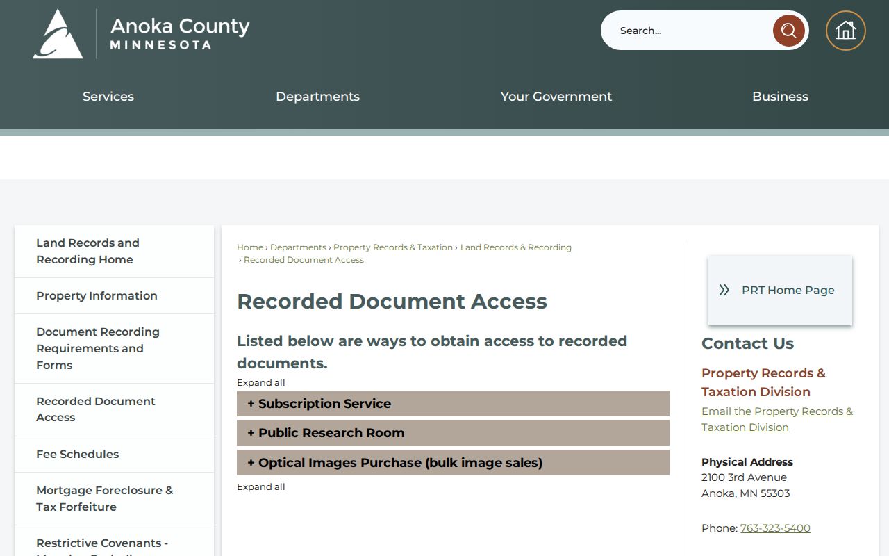
For prior residents research, the important distinction is between a party index for following conveyances and an image service that does not include that index.
Andover Plats Bridge Descriptions
Andover address changes are not the only obstacle in an old house trail. A newer Andover subdivision parcel can be described by lot, block, and plat, while an earlier deed may use a parent tract or a metes-and-bounds section description. County GIS offers Andover plat and half-section views, and ACHS holds land-ownership plat maps emphasized for 1888, 1914, and 1932. Comparing them can connect the modern parcel’s legal description to the geography used in a prior transfer.
No official Andover street-renumbering or street-renaming project was located in the research. Do not invent one to explain a failed address search. Instead, test the PIN, section-township-range or plat terms, adjacent communities, rural routes, Grow Township, and Round Lake Township. The city map and county GIS are the best documented bridges between current municipal geography and earlier labels.
Andover Previous Residents in Directories
The Minnesota Historical Society’s verified local collection is an Anoka County telephone-directory run. The MNHS finding aid identifies Andover holdings from 1978 through 2005, with incomplete print, microfiche, and Yellow Pages years, plus a 2011 to 2012 Yellow Pages volume. Andover White Pages can supply an Andover subscriber name, number, and street address. Andover Yellow Pages organize businesses by subject, so they do not answer the same household question.
The volumes do not establish a continuous address list. The research did not locate a separate official Andover reverse directory or verify that every local telephone book contains a street section. Families are generally listed by the head of household; minors are usually absent, and women commonly appear when independent, single, widowed, or divorced. A missing name may reflect a listing choice, no telephone subscription, a move, or a gap in the holdings.
The collection details belong on the Andover city directory page. Here, pair the closest available volume with the deed date and parcel description rather than treating a telephone entry as a complete household record.
Andover Census Years Paired
Use Andover census material as dated context between deeds and directories. ACHS holds Andover-area Anoka County census material from 1857 to 1920, while the MNHS People Records search includes state census material from 1849 to 1905. Federal census releases follow the 72-year rule, with 1950 the latest complete federal census available at the research date. An Andover census record is a snapshot of its own enumeration date, not a substitute for a transfer record before or after that date.
The pairing sequence is simple: address and PIN to parcel, parcel to deed, then the directory or census nearest the interval in question. Compare spelling, township or city label, household-head convention, and land description. An obituary, cemetery entry, probate record, or newspaper announcement can then help explain why the next deed or directory entry changes.
Andover Previous Residents Before 1974
Andover’s municipal labels changed over time. The present area was organized as Round Lake Township in 1857, renamed Grow Township in 1860, became the Village of Andover in 1972, and the City of Andover in 1974. The area also included what is now Ham Lake until 1871. A pre-city record may therefore be filed under a township, station, rural-route, or nearby-place name instead of the modern city name.
The local name itself carries a useful caution. City history says Andover was associated with the area before the railroad arrived in 1899, so the story that a train accident created the name is not supported. For a prior-resident search, this history matters because the correct place term, not a colorful story, is what improves a catalog, newspaper, or land-record query.
Andover House History Help
The Anoka County Historical Society house-history guidance directs researchers to on-site tools, microfilm help, and preparation for a local-history search. ACHS maintains maps, newspapers, yearbooks, cemetery indexes, census material, photographs, selected church and civil records, and subject files. Its Anoka County Union microfilm runs from 1865 to 2002, and the Anoka Herald from 1885 to 1960. Those records can put a deed or address change into a dated family or community context.
The center offers an initial search of about 15 minutes without charge. More research is billed at $20 per hour, with photocopies at $0.25 per page plus postage. Staff ask for the family, event, or subject, time and place, and desired output; they do not read obituary microfilm without an exact death date. The collection is substantial, with more than 17,000 photographs, 19,000 objects, and over 250 oral histories, but the online database is not the full collection.
The house-history research guidance shows the kinds of records and preparation available through ACHS.
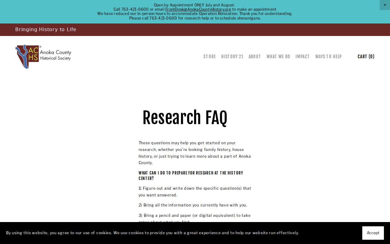
That local archive route is particularly useful when the parcel and recorder trail reaches an older map, newspaper, or township era.
Andover Previous Residents Endpoints
Once a former owner or subscriber is identified, use life and estate sources with the same care. ACHS indexes birth, death, and marriage announcements by date and last name, holds Thurston Mortuary records and burial information for many cemeteries, and keeps local newspapers. Probate filings are handled through Anoka County District Court. These records can help place a transfer in a family timeline, but they may be restricted or incomplete and should be checked with the custodian.
A recorder alert is different from house-history evidence. Anoka County Fraud Notify presents a login or sign-up route and explains email alerts for recorded-document activity. It can help a property owner watch for a new recording, but it does not prove ownership history or identify occupants.
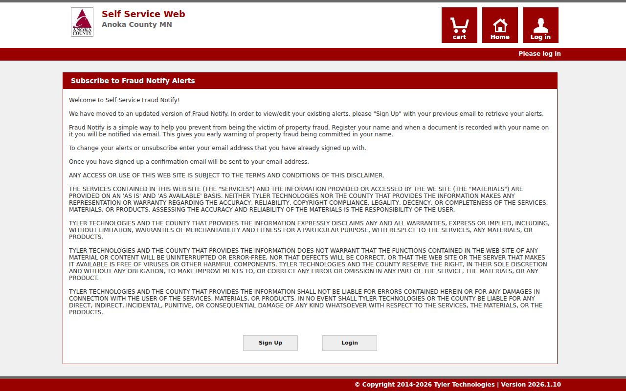
The alert page is a separate county record-monitoring option, not a substitute for reviewing the actual deed and legal description.
Andover Previous Residents Limits
Previous residents research has a firm boundary: a deed names parties to land transfers, while a parcel card lists ownership and tax information. Neither proves every person who lived at a property. Telephone directories can omit non-subscribers and household members. Protected records, Safe at Home addresses, motor-vehicle information, utility accounts, and other private data do not become public simply because an address is known.
Keep the source, date, parcel identifier, and access limit beside each fact. If an official record is unavailable online, ask the county or city custodian for the specific public file rather than relying on a copied address, an unverified database entry, or a claimed deed-history summary.
Note: A missing record can reflect a collection gap, a protected field, or an unstated online cutoff rather than a proven absence.