
Andover Neighbors by Block
Public sources answer different questions about the homes around an Andover address. The Andover county GIS map supplies the parcel pattern and nearby PINs. Andover Property Access supplies a tax-record view for each parcel. Recorded documents can extend an Andover ownership trail, while city material may provide public project or meeting context. No one source is a roster of every Andover neighbor, and the order of the sources keeps that limit visible.
| Source | What it shows about an Andover block | Access |
|---|---|---|
| Anoka County GIS parcel layer | Adjacent parcel polygons, PINs, addresses, plats, aerials, and district context | Free map with click, zoom, Near Me, and buffer tools |
| Property Access | Owner, owner mailing address, property address, class, homestead, value, and legal description | Free current search; portal terms prohibit mining |
| Recorder/Registrar of Titles | Deed chain and shared plat or legal-description context for a parcel | Subscription or Room 119 public research terminals |
| Minnesota public voter list | Limited public-list fields when lawfully obtained | Registered Minnesota voter, identification, certification, and use limits |
| City community and planning records | Public event, board, block-party, or project context | City pages, Agenda Center, or a public-data request; no citywide resident roster located |
An owner name on a parcel is evidence of ownership, not proof that the owner lives there. A non-owner occupant, another household member, or a protected person can be absent from the public property card. That distinction is central when researching Andover neighbors.
Andover Neighbors in Parcel Layers
The Anoka County Property Search GIS Mapping Application is the practical starting point for a small-radius Andover search. Its documented categories include address, multi-unit address, PIN with or without hyphens, plat boundaries, half sections, schools, and public buildings. For an Andover address query, the county instructs users to enter the house number and full or partial street name without city or punctuation. That makes it possible to start with a real Andover address even when the postal city label overlaps another place.
Andover parcel layers, plats, section lines, aerials, school districts, watersheds, and commissioner districts explain how nearby parcels relate. The map also offers historical and current aerials, print tools, measurement, drawing, a street-intersection search, and Mailing Labels. Mailing Labels can select Andover parcels by point, line, or polygon, choose owner or physical address labels, and export CSV or PDF. Use those controls to understand an Andover mapped segment, not to build a private household list.
Near Me accepts an adjustable radius and can export an Andover PDF report. Choose the radius deliberately, then record the date and layer used so the Andover search can be repeated. The official viewer is reference-only and does not guarantee accuracy, so a disputed boundary or identity needs a custodian check.
Anoka County says its Property Records & Taxation operation maintains more than 140,000 property records and processes about 75,000 real-estate documents each year. That scale is one reason an Andover parcel result should be checked by PIN and legal description, not only by a similar Andover street name.
Note: In Andover, postal labels, city limits, plats, and school or watershed districts can all place a nearby parcel in different geographic categories.
Map an Andover Neighbor Block
An adjacent-parcel process keeps the work tied to verifiable map objects. A block is not always one formal record unit in Anoka County. A modern map square may be described in land records as a plat, lot and block, a section-based tract, or metes and bounds. Start with the target parcel's PIN and legal description, then verify each adjoining parcel separately rather than treating a map radius as a list of people.
- Search the target Andover number and street in county GIS, select the parcel, and record its PIN, property address, plat, and map location.
- Zoom out with the Andover parcel layer on, or run Near Me with a chosen radius, then click adjoining polygons one by one for their own PIN and address links.
- Open each corresponding Andover Property Access record and compare the property address, owner address, ownership information, and homestead field without converting those clues into a household claim.
- Where a shared Andover plat or older legal description matters, move to the recorder's deed route or its Room 119 terminal. For a full named-street chain, use the Andover street directory.
The flow is address to GIS parcel, parcel PIN to Property Access, then legal description to recorded documents where needed. It is narrower than a street-wide search and better suited to understanding the parcels immediately around one Andover address.
Andover Neighbor Address Fields
Property Access separates the Property Address from the Owner Address. The property field identifies the situs, meaning the parcel's physical location. The owner field is where tax correspondence is sent. If both match and the parcel shows Homestead Yes, the record can support an owner-occupancy clue. It still cannot prove who is present in the home on a given day, and it does not identify other household members.
- PIN or PARID
- The county parcel identifier used to connect a mapped parcel to its tax and property record.
- Situs address
- The physical property address shown on a parcel card, distinct from a correspondence address.
- Homestead
- A tax-classification field that can be a useful clue, but is not final proof of occupancy.
- Plat
- A recorded subdivision map that can connect a group of lots to the legal description used in deeds.
An Andover GIS sample at PIN 34-32-24-43-0103 includes city, ZIP, SUNRIDGE plat, watershed and school fields, plus owner-address fields and links to a tax record, plat, half-section map, and historical aerials. It illustrates the fields to read, not the people who may be present at that address.
Andover Neighbor Community Contacts
Andover's public community layer is real, but it is not a neighborhood-membership directory. City pages document block parties, public events, city boards, the Community Center, parks, and polling-place facilities. The planning record contains a project-specific reference to Miller's Woods HOA. No official citywide HOA or neighborhood-association directory, umbrella organization, member list, or contact roster was located. The table keeps the available public routes and the gaps together.
| Public community route | Contact or access | What the research supports |
|---|---|---|
| Miller's Woods HOA | Planning and agenda material through the City Agenda Center | A project-specific HOA reference; no public roster or association contact was located. |
| Andover City Clerk | 1685 Crosstown Boulevard NW, 763-755-5100, Monday through Friday 8:00 a.m. to 4:30 p.m. | Routes city records and Minnesota Government Data Practices Act requests for public city material. |
| City boards and community records | Andover Agenda Center | Searchable public agendas and minutes for City Council, Planning & Zoning, Community Center Advisory, and other listed categories. |
| Polling-place community anchors | Andover elections page | Names public facilities and churches used as polling places, but does not provide member directories. |
The Andover Agenda Center is the source for the public planning and community-record route shown here.
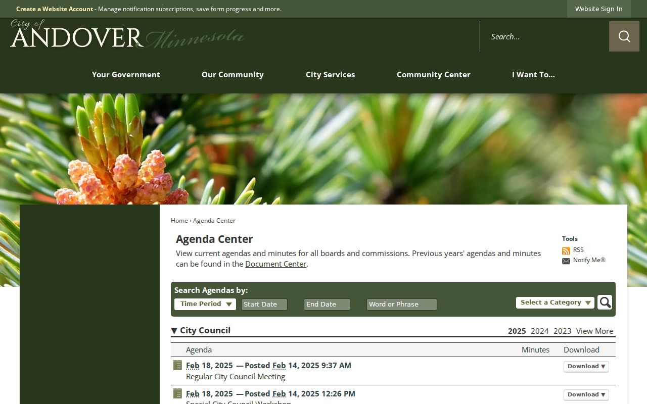
Agenda and minute searches can reveal a public project or civic action. They should not be read as a roster of everyone living in an Andover neighborhood.
Andover Neighbors and Voter Data
Minnesota does not provide a lawful public web view for browsing neighbors by voter address. The public information list may include name, address, birth year, voting history, optional telephone number, and district information, but Minn. Stat. §201.091 requires identification and a written certification. The law also forbids putting the data into an Internet-searchable database and restricts sale, lending, or surrender of list information.
The state's Check Registration tool is for a voter checking their own status, precinct, and polling place. The county-hosted request form describes controlled report formats, including household mailing labels and walking lists, but says the requester must be a registered Minnesota voter and certify the permitted use. Verify the current form before relying on its older price or delivery details.
Safe at Home participants and voters with safety withholding may have protected address treatment. Do not treat the absence of a voter-list result as evidence that a neighbor is not there.
Andover Neighbors: Official or Commercial
Official parcel and city records identify their custodian, field type, and access rules. Commercial neighbor-lookup products generally combine property, court, address, and marketing material through geocoding. That can be quick, but it may merge people with the same name, miss non-owner occupants, retain stale material, or omit protected records. The county map and tax card make it easier to see exactly which claim belongs to a parcel and which does not.
| Record category | Useful for | Boundary to keep in view |
|---|---|---|
| Official GIS and Property Access | Parcel location, ownership fields, map layers, and legal-description context | Owner is not automatically an occupant; data are reference material. |
| Recorder records | Recorded deed parties, dates, and property descriptions | Older research may need the counter or subscription; address alone may not retrieve old instruments. |
| Commercial neighbor category | Broad address-linked leads that require verification | May be stale, merge names, or leave out protected and non-owner people. |
For a suspicious deed-copy letter or an unsolicited county-appraiser call, verify independently with Anoka County Property Records & Taxation at 763-323-5400 rather than relying on the caller or mailer. The county's official record route is also the right source for current copy fees.
Andover Neighbor Block Geography
Nearby parcels can share a street while falling into different mapped contexts. The city address map includes parcels, section lines, city limits, MUSA, parks, preserves, and waterbodies. County GIS adds plats, half sections, aerials, schools, watershed districts, commissioner districts, and other geographic layers. Those fields help explain a block without claiming that an administrative district is a resident list.
Andover's history makes boundary checking more important for old records. The area was Round Lake Township in 1857 and Grow Township in 1860 before Andover became a village in 1972 and a city in 1974. The earlier township terms, rural routes, and neighboring place labels can be necessary in archival searches. There is no official Andover street-renumbering history in the located research, so no renumbering date should be assumed.
Named features such as Coon Creek, Round Lake, Bunker Lake, Ward Lake, Lake Leman, and Rum River can help distinguish nearby map results. They are geographic anchors only, not evidence about a household.
Keep the Andover map terms together while taking notes: Andover address, Andover PIN, Andover parcel, Andover plat, and Andover legal description. That small Andover vocabulary prevents a map result from being separated from the property record that explains it.
For geography, compare the Andover city-limit layer, Andover MUSA line, Andover waterbody layer, Andover park layer, and Andover school or watershed context. Each Andover layer answers a place question, not a question about every person nearby.
For records, compare an Andover GIS selection, an Andover Property Access result, an Andover Recorder record, an Andover city request, and an Andover archive citation. These separate Andover sources can agree on a parcel while leaving occupancy private.
Andover Neighbors in Older Records
For a past block picture, the documented telephone-directory run begins in 1978 and continues through 2005 with gaps, plus a 2011-2012 Yellow Pages volume. The Minnesota Historical Society finding aid and the Anoka County History Center are the better routes for a dated subscriber, map, newspaper, cemetery, census, or photograph lead. A missing telephone listing does not prove no one was present, because a subscriber listing is not a census.
The History Center has Anoka-area newspapers dating to 1863, naturalization material, 1857-1920 census resources, selected church and civil records, and maps. Its online collection is a work in progress, and some materials are restricted. Call before visiting with the street, former surname, township label, approximate years, and record type.
An older Andover neighbor search should also note Andover, Grow Township, Round Lake Township, the Andover street, and the Andover plat or section description. Those Andover terms reflect the change from township records to the modern City of Andover.
Andover Neighbor Record Limits
Non-owner occupants, other household members, utility customers, delivery records, motor-vehicle addresses, protected voters, victim or survivor addresses, and nonpublic court material do not become public just because a parcel is nearby. Minnesota's Safe at Home program uses a designated PO Box and protects program data under Chapter 5B and related data-practices provisions. Do not attempt to reverse a substitute address or use a parcel record as a way around protected information.
For an Andover public city record that is not posted online, ask the Andover City Clerk for the appropriate request route under Minn. Stat. §13.03 and request a copy estimate if staff must search or redact material. The custodian, rather than a private compilation, can explain whether an Andover field in an Andover record is public. An Andover request should stay tied to the identified Andover parcel or address.
State the narrow Andover need in a request: an Andover address, an Andover parcel, an Andover date range, an Andover record type, and an Andover public field. That preserves the limit between an Andover records question and a request for private information.